
There appears to be no universally accepted definition of desert; indeed, by some definitions, the Chihuahuan Desert is classified as a semi-arid region rather than as true desert. The Centennial Museum's Chihuahuan Desert pages has an introduction to the Chihuahuan Desert that includes a short section on deserts in general as well as specifically on the Chihuahuan Desert. Wikipedia has a more expansive discussion.
You'll find a number of websites with descriptions and maps of deserts. If you look at them carefully, you'll see that many of them don't agree with one another. In part this is due to the differences in opinion as to the definition of desert; in part, to sloppy work. As always, the approach to the internet should be "viewer beware".
The Mojave National Preserve introduction to world deserts gives a fairly nice, concise description of the factors causing deserts. There are places, however, where a good editor could be used to advantage, and the map (see below) is lacking in accuracy (note that it appears as though the Chihuahuan Desert extends to the Gulf Coast), though giving an approximation of desert distribution.
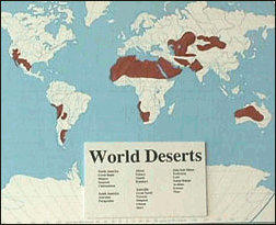
The Mohave world deserts. Courtesy of the U.S. National Park Service.
A table of information about the deserts of the world is given by infoplease.
The map below is from the NASA Jet Propulsion Laboratory (NASA-JPL) (ID: PIA03443) with some labels added. Only the northern portion of the Chihuahuan Desert is included (the white sands of the Tularosa basin is clearly visible). NASA's description appears below the image.
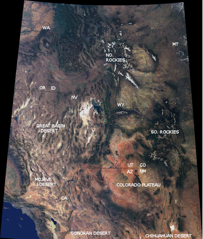
The breathtaking beauty of the western United States is apparent in this image from the Multi-angle Imaging SpectroRadiometer on NASA's Terra spacecraft. Data from 16 different swaths acquired between April 2000 and September 2001 by MISR's vertical-viewing (nadir) camera were used to create this cloud-free natural-color image mosaic. The image is draped over a 100-meter (328-foot)shaded relief Digital Terrain Elevation Model from the United States Geological Survey.
Among the prominent features are the snow-capped Rocky Mountains traversing Montana, Wyoming, Colorado and New Mexico. In the northern portion of the image, the Columbia Plateau stretches across Washington, Oregon and Idaho. Many major rivers originate in this region, including the Missouri to the east of the Continental Divide, the Snake to the west, and the Colorado which wends across Utah and Arizona. The Colorado Plateau and vibrant red-colored rocks of the Painted Desert extend south from Utah into Arizona. In the southwestern portion of the image, California's San Joaquin Valley and the Mojave Desert of California and Nevada give way to the Los Angeles basin and the Pacific Ocean. Most of the Chihuahuan Desert is south of this view. White Sands, in southern New Mexico, is visible at the bottom right. The Rio Grande can be traced north from about the second "H" in the CHIHUAHUAN DESERT label.
Last Update: 15 Nov 2007