
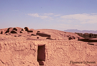
Ruins at Casas Grandes.
Recent research has not only reaffirmed the importance of the influence of Casas Grandes, but has shown that from about A.D. 1200 until around 1425, the Casas Grandes Regional Culture held sway over a large area that included northern Chihuahua, Far West Texas, and much of southern New Mexico, as shown on the map below.
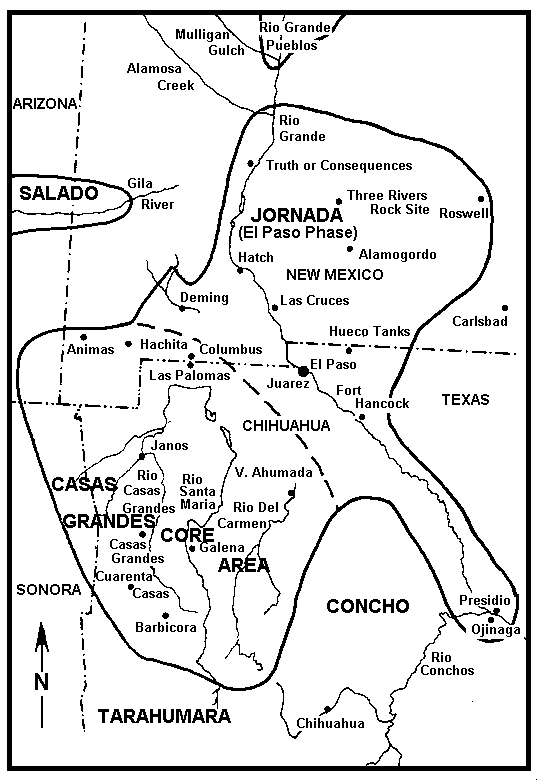
Casas Grandes Cultural Region, ca. A.D. 1200 - 1425. The dashed line represents the core region as mapped in the earlier years of this century. The heavy line represents current understanding. After Schaafsma (pers. commun., 1997).
Furthermore, the chronology of the region has been clarified.
Following the collapse of Casas Grandes culture, other groups arose in the region, as shown in a second map. These were the cultures encountered by the Spanish as they penetrated the region.
All figures are based on work by Curtis Schaafsma (pers. commun., 1997). Copies are available from the Library of the Laboratory of Anthropology, in Santa Fe, NM (the library may be reached at (505) 827-6344, extension 546).
Last updated 27 Sep 2006
