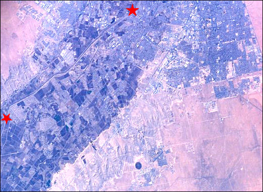

In the early days of the Spanish, our region's Rio Grande Valley was green with riparian woodlands, known to the Spanish as bosques, interspersed with marshes and oxbows. The present valley floor has been built up by the river meandering from side to side. As it dropped its loads of silt and sand, its bed and natural levees rose above adjacent areas, with the river eventually shifting to those lower grounds. Meanders cut off from the main river bed formed oxbows, paradise for aquatic creatures and waterfowl. But meandering back and forth rather than proceeding in a straight line means a lot of surface area for evaporation, and a river shifting aimlessly tends to excite farmers.
The solution, in the eyes of the powers that be in agriculture and the
government, was canalization—turning the river into the equivalent of a canal
bounded by levees to save water and keep the river in a now-straightened bed. One needs
only to go farther north in New Mexico to see that price we've paid for
"civilizing" the once magnificent Rio Grande.

Contributor: Arthur H. Harris, Laboratory for Environmental Biology, Centennial Museum, University of Texas at El Paso.
Desert Diary is a joint production of the Centennial Museum and KTEP National Public Radio at the University of Texas at El Paso.

El Paso Valley. The two red stars mark a portion of the canalized Rio Grande. The patchwork band running diagonally from the lower left to the top is the floodplain, over which once the Rio Grande would have meandered. Satellite photograph ISSOO8-E-13220, image courtesy of the Image Science and Analysis Laboratory, NASA Johnson Space Center.